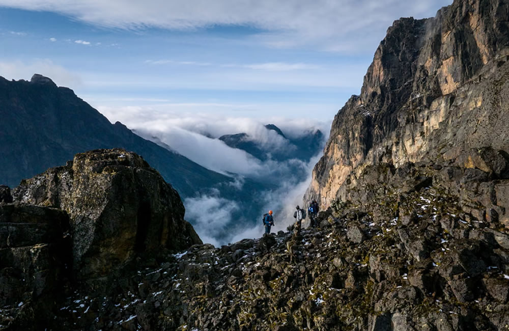
Nestled along the border of Uganda and the Democratic Republic of Congo, the Rwenzori Mountains—often referred to as the “Mountains of the Moon”—have long attracted explorers, scientists, and adventurers. These snow-capped peaks, rising above lush equatorial forests, represent one of Africa’s most unique and fragile environments. Yet, these legendary glaciers are vanishing at an alarming rate.
To understand the pace and impact of this transformation, a team of scientists, mountaineers, and local guides recently embarked on a groundbreaking expedition to map the extent of ice loss in the Rwenzori range.
Historical Context
The glaciers of the Rwenzori Mountains have been a source of fascination since European explorers first documented them in the late 19th century. Once spanning approximately 7.5 square kilometers, these equatorial glaciers have diminished dramatically over the past century, with a reduction of nearly 90% according to scientific records. Where thick ice once shaped ridges and fed streams, exposed rock and fragile alpine vegetation now dominate. This retreat has profound implications for biodiversity, water systems, and local communities that depend on mountain catchments.
Objectives of the Expedition
The expedition to map ice loss in the Rwenzori Mountains aims to:
- Quantify glacial recession: To measure the rate and extent of ice loss by comparing new data with historical records and installing new monitoring equipment.
- Assess environmental impact: To evaluate how glacial recession affects alpine ecosystems and river flow, which are vital for local communities and hydroelectric power.
- Monitor and model climate change: To collect data for long-term environmental monitoring and to build high-precision 3D models of the glaciers to better understand and predict future changes.
- Raise awareness: To document Africa’s vanishing glaciers and use the findings to highlight the global water crisis and the local cultural and spiritual impact of disappearing ice.
- Empower local communities: To develop the capacity of local scientists and institutions, like Makerere University and the Uganda Wildlife Authority, to continue monitoring and to inform decision-makers
Methodology
To achieve these objectives, the research team combines multiple scientific approaches:
- Satellite data analysis: Multi-temporal satellite imagery is used to track changes in glacier surface area over recent decades.
- Aerial and drone mapping: High-resolution aerial photography and drone surveys provide detailed imagery for constructing digital elevation models.
- GPS and ground truthing: Precise GPS equipment aids in tracing glacier edges and validating remote-sensing data.
- Climate monitoring: Automatic weather stations collect temperature, humidity, and precipitation data to correlate climate trends with ice loss.
- Hydrological sampling: Water flow measurements and isotopic analysis help determine the contribution of melting ice to streams and wetlands.
Challenges in the field
Conducting research in the Rwenzori Mountains presents significant logistical and environmental challenges. The terrain is rugged and often waterlogged, with steep slopes, deep bogs, and unpredictable weather conditions. High elevations expose researchers to hypoxia and severe cold despite the mountains’ equatorial latitude. Additionally, transporting scientific equipment through dense forest and fragile alpine zones requires careful planning and support from local porters and guides. These challenges stress the dedication and collaboration required for scientific missions in the region.
Findings and emerging trends
The Rwenzori Mountains have three main peaks, Mt. Stanley, Mt. Baker and Mt. Speke. The ice on Rwenzori is the highest and most permanent source of the River Nile and constitutes significant water catchment areas in Uganda, relied upon by five million people.
After the Rwenzori trekking expedition, findings show that Mt. Speke and Mt. Baker have lost their glaciers, while the surface of the Stanley Plateau Glacier has decreased by 29.5% since 2020 and is undergoing severe fragmentation. This highlights the rapid ice loss in East Africa, with profound consequences for climate science and spiritual heritage.
Implications for conservation and local communities
The loss of glaciers represents both a scientific warning and a cultural loss. For the Rwenzori’s Bakonzo people, loss of the ice has enormous cultural implications. The Bakonzo hold deep spiritual beliefs that are intricately connected to the natural landscape, particularly the snow-capped peaks.
A central belief is that their gods, Kithasamba and Nyabibuya, reside in the ice of Rwenzori. For centuries, this spiritual connection has influenced how the Bakonzo interact with their environment, reinforcing conservation efforts and sustainable use of natural resources, long before colonial or modern times.
Conclusion
The expedition to map ice loss in the Rwenzori Mountains is more than a scientific undertaking—it is an effort to document a disappearing phenomenon and to understand the cascading impacts of climate change on one of Africa’s most remarkable landscapes.
s glaciers recede and ecological systems shift, the research serves as a crucial foundation for conservation planning, climate adaptation, and public awareness. The story of the Rwenzori glaciers is a poignant reminder that even the most remote and revered environments are not immune to the global climate crisis. Their fate calls for swift and sustained action to protect vulnerable ecosystems and the communities they support.